
THE GOAD'S GUIDE: FIRE INSURANCE PLANS IN CANADA
THE HISTORY OF FIRE INSURANCE PLANS
.jpg)
The story of Charles Goad's fire insurance plans is a fascinating Canadian saga that begins with a Victorian entrepreneur's scheme to map towns across the country for initially skeptical insurers, progresses into an essential corporate enterprise stewarded by national insurance organizations, and ultimately transitions into a priceless public resource for historians.
Prelude to Goad (1800-1875)
Fire Insurance Plan Origins
Fire insurance plans were detailed diagrams of town and city blocks that helped insurers calculate fire risks for homes and businesses and determine premiums for their owners. They first appeared in England in the late eighteenth century and were hand drawn by insurance company surveyors for the exclusive use of the firm. These plans arrived in Canada in 1808 when the Phoenix Assurance Company of London had them prepared for a handful of cities in the Maritimes and Quebec between 1808 and 1845.
Advances in lithographic printing in the 1840s and 1850s led to printed versions of the plans coming into general use and, at the same time, the arrival of the railway and consequent rapid expansion of town sizes increased the need for such plans.

Detail from 1858 Atlas of the City of Toronto. Red shading depicts stone or brick, grey denotes wooden structures, "1" and "2" indicate building status, and red dots are fire alarm stations.
The oldest surviving Canadian plan is the Atlas of the City of Toronto and Vicinity created by William Somerville Boulton in 1858. While not specifically labelled as a fire insurance plan, the atlas’ content was very much in line with such a purpose. Drawn at a scale of 100 feet to 1 inch, it depicted the nature and size of every structure in the coverage area including basic construction material (stone or brick versus wood frame), and their first- or second-class building status. It also indicated the location of the city’s public fire alarm pull-stations.
D. A. Sanborn Plans
South of the border, Daniel Alfred Sanborn responded to the need for similar plans in the United States. He created his first maps in 1866 on contract to Aetna Insurance for areas of Tennessee. Seeing the nation-wide potential of these products, he founded his own company dedicated to their production and sold them to interested insurers.
Most Sanborn maps were drawn at a scale of 50 feet to the inch allowing for a significant level of detail, with less developed suburban areas drawn at 100 or 200 feet. This necessitated very large pages, generally 21” by 25” in size.
In addition to depicting footprints of the surveyed buildings, Sanborn noted street widths and street numbers along with an array of specifications relevant to a structure’s fire risk: building materials such as concrete walls, stucco siding and various roofing compositions, number of storeys, number of windows, location of municipal fire fighting equipment and the direction of prevailing winds.
Typically, the focus of these maps was a town’s business section where commercial tenants were presumably more likely to insure their properties than were private homeowners

D. A. Sanborn fire insurance map of Guelph, 1875, revised 1878 by Charles Goad.
In the summer of 1874, Sanborn expanded his offerings into Canada, publishing maps for Quebec City and 14 Ontario locations over the course of a year[1]. The arrival of these surveys soon caught the eye of a fellow civil engineer in Montreal by the name of Charles E. Goad.
Charles E. Goad (active 1875-1910)
An Ambitious Start

Charles Edward Goad was born in England in 1848 where it appears he was self taught or served an apprenticeship in drafting before being employed in the building of public works[2]. He emigrated to Montreal in 1869 at the age of 21 and worked as an engineer on the Toronto, Grey and Bruce Railway until 1873. That year, Goad married Margaret Brown and went to work with the contracting company that built the Montreal Northern Colonization Railway, first as a drafting-office manager and eventually as chief engineer.
The earliest of Goad’s business records now held by the Archives of Ontario is a circular[3] from December 1875 addressed to "Managers of Fire Insurance Companies Doing Business in the Dominion of Canada.” The 27-year-old engineer informed recipients that he was about to be "disengaged" from his fulltime job until the following spring and would use the time to produce “reliable plans of cities & towns for insurance purposes.” The venture was predicated on a belief that competing insurance companies would agree to share a strategic resource that had previously been strictly proprietary, an aspiration Goad later admitted his contemporaries found foolish, advising him "not to waste his time and money".
Goad stated he would begin with the town of Lévis opposite Quebec City on the St. Lawrence River “intending should I receive sufficient encouragement to make plans of other towns”. In his next circular two months later, he explained that his choice of Lévis was due to its being “the largest [town] in Canada not surveyed by Mr. Sanborn of New York” and noted that ten of the principal insurance companies based in Montreal and Quebec City had already signed on to the venture[4].

Goad's introductory circular from December 1875.
By April 1876 Goad had not only completed surveys of Lévis and nearby South Shore Coves but also of the business parts of five towns in western Ontario, namely Stratford, Galt, Goderich, St. Mary’s and Brampton. Writing from his newly established office at 162 St. James Street, he proposed to divide the cost of the resulting insurance plans among companies willing to fund his endeavor through advance subscriptions.
A lengthy circular issued in August 1876 provides extensive insight into Goad’s vision for his business. It began by announcing that he had surveyed another 11 towns in Southern Ontario for a total of 18 and was proposing a “general system[5]” drawn to a scale of 40 feet per inch on 25” x 21” sheets that would show "every building in the business and manufacturing parts of various towns with information as to character of buildings, roofing, firewalls, openings, exposures, occupations, tenants, water supply and appliances”. This format was virtually identical to that of the Sanborn maps save for the slightly larger scale, a variance that lasted only a few months until Goad adopted the American’s 50-foot standard. The copycat format, combined with the circular’s announcement that Goad would soon revise Sanford’s original maps, strongly suggest that Goad’s eventual takeover of his competitor’s Canadian venture was already in motion by this time.
Goad proclaimed his standardized plans would allow head offices to issue quotes more quickly, provide a common reference for management and their local agents, and act as a check against errors.
Goad touted the benefits of his system for an industry wherein underwriters and head office managers based in large cities assessed applications submitted by local agents situated in smaller communities, many of whom represented multiple firms. He proclaimed that his standardized plans would allow head offices to issue quotes more quickly by having the relevant background information at their fingertips, provide a practical common reference point for management and the local agents they employed, and act as a check against errors or outright false information provided by said agents.
At the same time, he acknowledged two primary concerns about his proposed system: the substantial cost of producing the plans and the necessity of keeping them current. Goad guaranteed that he would update the plans regularly to ensure their ongoing relevance but this only added to the cost which was considerable; each map required surveyors to measure and draw the plans, printers to lithograph black and white prints, and staff to hand stencil watercolours onto the printed copies.


This 1876 Napanee plan is one of only two extant maps from Goad's first year of business.
Goad indicated that his ideal scenario would be to complete surveys of every town and city having a population above 3,000 in Ontario, Quebec, the Maritimes and Newfoundland over the subsequent four years and then revise those plans with 18 months of their creation, along with the Sanborn maps. He estimated the cost on a per annum basis of $6,000 which would be divided amongst as many subscribers as he could obtain. He cited an example of 10 companies each contributing $600 per year for this service and, while admitting this was a substantial sum, Goad also reminded his readers that it was but a fraction of the $4.3 million in revenue collected by the insurance industry in the year prior.
However, Goad was practical enough to acknowledge the limitations imposed on this scheme by the high cost of production and the relatively low number of potential clients. He confessed that it was “probably now premature” to execute and settled for a more modest proposition to continue surveying small groups of towns and splitting each plan's cost among interested subscribers.

April 1877 circular listing existing plans and their purchase price.
This would become Goad’s permanent business model. While many contemporary sources state that his customers leased the plans rather than owning them outright, the circulars don’t bear this out. True, Goad referred to his clientele as subscribers but apart from his wild dreams of annual payments in this missive, successive circulars refer to individual pricing for each original edition and their subsequent updates. This was definitely a pay-per-use business model. Pay-before-use would be a more apt description. The surveying process was an expensive one and Goad continually appealed to customers to purchase the resulting plans prior to their creation to offset his own investment. He would further hedge his bets by selecting new towns based on an expressed interest from at least one insurer, hoping that others would come on board once the final plans were issued[6].

1902 conditions of free loans to field agents and description of the plan revision process.
Rapid Expansion, Mounting Losses
Despite his best attempts, Goad had a difficult time convincing insurers to sign on for his surveys. He had previously posted a net loss on his original seven plans and his update in the August circular indicated an even larger deficit on the 18 plans to date. By his count, there were 30 insurance companies that provided service across the country and while he had received support from 21 of them, most of that was “not to the extent that their operations should warrant.”
Operating at a loss became one of two recurring themes in Goad’s circulars through the 1870s. The second was his determination to forge ahead with new plans despite the shortfalls.
Operating at a loss became one of two recurring themes in Goad’s circulars throughout the 1870s, frequently accompanied by admonishments to customers turning a blind eye to their agents sharing of their plans with non-paying competitors, and who took a “spasmodic” or ad hoc approach to purchasing plans instead of a “systematic” or comprehensive commitment that would have provided more stable funding.
The second consistent theme was Goad’s determination to forge ahead with new plans despite the financial shortfalls. He was eternally optimistic that his system would eventually become widely adopted thus spreading the survey costs across a broader base and lowering the price per customer.
In January 1878, Goad began to revise the 15 Sanborn plans using a novel approach designed to reduce costs. Instead of redrawing, reprinting and recolouring entire sheets, he created small cutouts for only the portions that required updates. Subscribers would then ship their original plans to him for his staff to paste on the patches and return the updated maps.
The Goad System


This double-sided, 9" x 4" handout was both practical and promotional. Its nominal use was as a handy scale to measure distances in Goad's insurance plans; one side of the heavy card stock featured the default scales used for the majority of sheets in a plan (40 or 50 feet to the inch) while the other side had smaller scales used for sheets covering suburban areas (100 feet) and key plans (400 feet and 500 feet).
Supplementing these scales were illustrated comparisons of Goad's universal system of surveys versus traditional agent-supplied drawings. On one side of the handout, exasperated underwriters attempting to interpret agents' "old style diagrams" are contrasted with a group of insurance executives leisurely referencing the "new method plans". On the reverse, an agent drawing his own diagrams while frustrated customers wait impatiently is compared to a competitor referring his copy of "Goad's plans" to a stream of satisfied clients.
Also included is a promotion for Goad's self-made publication Insurance Society which issued regular updates of new towns added to his inventory of plans.
Even when obliged to take on work as a chief engineer for Halifax and Cape Breton Railway to supplement his income in 1877 and 1878, Goad continued his prolific output:
-
By April 1877, 12 additional surveys proposed in his August 1876 circular were completed, bringing the total number of original plans to 30.
-
In February 1878 Goad closed the deal on buying out Sanborn’s Canadian subscribers. They agreed to a collective price of $600 which Goad would pay in the form credit towards subscriptions to his own plans.
-
A September 1877 proposal to expand into towns in the “Lower Provinces” received enough support for Goad to create his first three Maritimes plans by the summer of 1878.
-
By December 1878, Goad’s inventory had more than doubled from the year prior to a total of 83 plans, albeit at a cumulative loss of $2,100.
-
A price list published just a month later included a total of 87 plans, consisting of 61 communities in Ontario, 11 in Québec and 15 in the Maritime provinces. The most notable addition was Montreal, a significant accomplishment considering that the metropolis was twice as big as Toronto, the country's second largest city.
-
In March 1880, Goad proposed to survey Winnipeg that summer making it the first municipality west of Ontario to be added to his ever-growing body of work.
-
Two months later, the tally had reached 135 cities and towns, and Goad relocated to his offices to St. Francis Xavier Street.
-
A January 1881 circular lamented the number of companies that borrowed plans rather than purchasing them, particularly the head offices of British-based insurers (i.e. the majority of insurance companies operating in Canada)[7] who had yet to be convinced of the product’s value. However, Goad claimed that his system was now well established with a total of 212 surveys available.
-
The survey total reached 280 in 1883 and, with the great majority of those being for Ontario communities, Goad decided to open a Toronto office that was initially located at 62 Church Street.
On top of all this, Goad somehow also found time to create his first city atlas, launch a trade magazine, and issue fire risk reference books to supplement his plans.
Other Goad Publications
Insurance Society

Charles Goad introduced his Insurance Society periodical in January 1881[8]. Its stated objective was to foster "a friendly feeling" amongst insurance companies which, not surprisingly, would support his attempts to sell a common set of surveys to rival agencies. Failing that, the publication also included regular summaries of financial losses from fires across the country and statistics that highlighted the reduced payouts of plan-owning insurers. Goad sold the magazine in 1886 due to increasing demands on his time and the new owner retitled it The Insurance and Financial Chronicle.
Reference Books


In late 1880, Goad mailed copies of his Oakville, Ontario fire insurance plan to customers with an accompanying prototype Reference Book that listed fire risks and estimated insurance costs for each structure in the survey. This was intended to be another "sister enterprise" designed to increase support for his primary offering. By the summer of 1882 he had received enough encouragement to issue a series of these books to supplement 16 other Ontario plans.
12 of these books have survived as a bound volume held at the Archives of Ontario. Each book begins with a one-page overview of general fire risks for the town. The remainder provides relevant information for every residential and commercial building in every sheet of the town's plan, consisting of address, owner, occupants, occupation, structure condition (ranging from good to "rotten") and, most impressively, the building's value and suggested fire insurance premium.
The effort required to compile these publications would have been enormous, requiring a substantial amount of sales to recoup Goad's costs. Presumably this did not happen as there are no further mentions of this initiative in his correspondence.
Turning Point


Charles & Margaret Goad, Christmas 1879
By March 1885, Goad had produced 340 plans in the Dominions of Canada and Newfoundland and it seemed there was no end to his business’ expansion. However, the successive months brought a dramatic change of fortune. In May of that year, Goad’s wife Margaret died at the age of 33 leaving Charles to raise their three young children. Then in September, Goad announced that his ongoing struggle to cover his costs had led him to lay off some of his staff as an alternative to raising prices. That same year, he closed the Toronto office.
Faced with such dramatic setbacks, Goad’s solution was true to form: sail to England to seek new opportunities.


March 1885 circular proposing the first London plan (left) and Volume 1 of the actual plan from March 1886 (right).
Goad’s London venture was an audacious one considering that he was a provincial outsider in a city with a population larger than all of Canada that served as Europe's defacto business capital. But he had two important factors working in his favour: his familiarity with many British insurers through their Canadian subsidiaries and the lack of a competitive offering.
The impact was immediate. In January 1886, Goad reported that he had received enough encouragement in preparing plans of London to enable him to not only retain but also increase the staff working on the Canadian series. He also registered his British business as Chas. E. Goad Limited and established a London bureau under the management of his brother James Sidney Goad. Within just two years the office would produce volumes of plans for 12 cities in England, two in Scotland and one in Ireland.
At the same time as he was turning around his business, Goad rebuilt his family. In August 1886 the 38-year-old-widower exchanged vows with 20-year-old Agnes Harriss in in Montreal. They would go on to have four children as Agnes followed him around the world, with the first one being born in London, England nine months after the wedding.
From Wild West to Middle East
Goad returned to the expansion of his Canadian offerings in September 1887 with his first surveys in the future Alberta and Saskatchewan which were then still part of the Northwest Territories. In the following month, he completed his westward push by securing the rights to D. A. Sanborn’s maps of British Columbia cities that were apparently exempt from his original deal with the American firm[9]. That same year, he relocated his Montreal office to Notre Dame Street and re-opened a Toronto bureau, this time at 2 Toronto Street.

“The series now extends from the Atlantic to the Pacific Coast,” Goad proclaimed in July 1888, “embracing every plan that has been asked for by two or more Companies: and in this the fifteenth year of continuous work, comprises 423 surveys of compactly built business centres and surroundings.”
But why stop there?
Goad had first proposed expanding outside of Canada in 1883, two years before his London venture. That year he asked insurers to support the surveying of major cities in “West India Islands.”[10] However, this international initiative didn’t come to fruition until 1894 and by 1909 he had surveyed cities not just in the Caribbean but also in Mexico, Venezuela, Chile, Denmark, Egypt, France, Turkey, Mozambique and South Africa.
Back in his hometown, Goad and his wife welcomed their second son in 1890, the same year that the Montreal office returned to St. James Street although this time at the Temple Building. (When that edifice was demolished in 1906 Goad relocated to 302 St. James.) Meanwhile, the Toronto office was relocated to the Merchants Bank Building at 15 Wellington Street West by 1900.

The Merchants Bank Building, one-time home of Goad's Toronto office. The façade was later relocated to the atrium of the current Brookfield Place building one block to the south.
The couple had their first daughter while back in London in 1898 and Goad purchased a cottage on Centre Island in Toronto Harbour sometime in the 1890s. The family permanently decamped to Toronto in 1904, first living at 108 Pembroke Street. It was here that a second daughter was born when Charles was 55 years old. The following year the family moved to 80 St. George Street.
Industrial Plans


Goad also created fire insurance plans for commercial and industrial clients depicting factories, mills and grain elevators among other structures.
Final Years
Goad’s seemingly inexhaustible energy finally hit a wall near the end of the decade. A memoir in the the journal of the American Society of Civil Engineers recounts his final days:
In 1909 while engaged on a survey at Valparaiso, Chile, on behalf of the Fire Offices Committee, Mr. Goad had a paralytic stroke. As soon as he could be moved he was taken to England, the voyage being of much benefit to him. After a short stay, he returned to his home in Toronto, with his health so far improved as to encourage the hope that he would be spared for a number of years, but after a journey South and a short stay in Florida, he returned to Toronto in April, 1910.
Goad suffered a second stroke not long after his return and passed away on June 10, 1910 at the age of 62. The memoir recalled him as “a man of sterling integrity and indomitable energy, never happier than when he had difficulties to surmount” and noted that “he was entirely lacking in ostentation, and warm-hearted and loyal in his friendship.”
By the time of his death, Goad had made plans for over 1,300 Canadian places and amassed a fortune worth the equivalent of more than $16 million today.
By the time of his death, Goad and his assistants had made plans for over 1,300 Canadian places and, after initially struggling to cover his business costs, the determined entrepreneur had managed to amass a fortune worth $600,000, the equivalent of more than $16 million today.

Goad family monument in Mt. Pleasant Cemetery.
Chas E. Goad Company (1911-1917)
Insurance Industry Alliance
Following Goad’s death, his business was initially carried on by his estate's administrators until they sold it to his three sons in September of 1911. 33-year-old Charles Ernest Goad (C.E. Goad Jr.), 23-year-old Victor Albert Edward Goad (V.A.E. Goad) and 20-year-old James Lawrence Goad (J.L. Goad) agreed to the appraised purchase price of $151,000 which they would pay out over a term of 10 years. Charles Jr., who had been in charge of the British and overseas surveys for some time, took over as Managing Director of Charles E. Goad Limited in London as well as the Canadian business which was then incorporated as Chas. E. Goad Company.
The first item on the new firm’s agenda was adapting to challenges from Canada’s insurance industry.
Fire insurance plans had progressed from a “nice to have” to a fundamental tool of the trade.
The industry at the time was divided into tariff or Board companies and independent insurers. The former were regional groups of insurance firms looking to benefit from mutual cooperation and a fixed “tariff of rates” for members. The first such organization was founded in Nova Scotia in 1864 and by the turn of the century others had followed suit in Prince Edward Island, New Brunswick, Ontario and Quebec (combined), the Northwest Territories, and British Columbia. Among these groups, fire insurance plans had progressed from a “nice to have” to a fundamental tool of the trade. Insurance plan scholar Jean Dryden explains:
The fire insurance business depended on two types of documents: the plans and the rating schedules. The plans provided detailed pictures of the structures in a community from the perspective of the risk of fire. The rating schedules established the insurance premiums charged to the insured, which of course varied according to the risk depicted in the plans. Clearly, the plans were an essential tool in the conduct of fire insurance underwriting. As a CFUA employee told the Supreme Court of Canada, “our whole schedule rating system depends upon our plans.”[11]
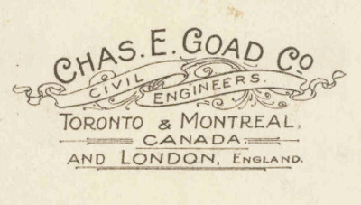
The CFUA referenced by Dryden was the Canadian Fire Underwriters’ Association which had jurisdiction over Ontario and Quebec. Seeking a competitive advantage for their members, they had approached Goad in 1908 about either providing his surveys exclusively for their use or allowing the association to purchase a controlling interest in his business. Goad was willing but insisted on a price that the CFUA found unacceptable. The organization persisted in their negotiations for two more years before deciding in December 1910 that they should produce their own plans instead. Their proposed Plans Department would engage a surveyor and assistants and sell its surveys at cost to member companies.
Goad’s sons decided that continuing business in the country's largest market solely with CFUA members outweighed the loss of sales to non-members.
In October 1911, one month after purchasing their father’s business, Goad’s sons took a different tack in the negotiations, deciding that continuing business in the country's largest market solely with CFUA members outweighed the loss of sales to non-members. Under the terms of the five-year agreement, the Goad Company would revise plans for Ontario and Quebec locations every three years except in larger cities where updates would occur every 18 months. “The association’s embryonic Plans Department,” says a published history of the CFUA and its successors[12], “was reduced to a skeleton staff, sufficient only to furnish plans for such small places requiring specific rating and for large manufacturing risks.”
Because the Goad Company maintained copyright ownership, the CFUA kept tight control of the circulating volumes by providing them to members on a loan basis which would be revoked if an insurer left the association.

Elsewhere in the country, the Goad Company continued to publish largely unchallenged by competitors with the exception of Manitoba, Saskatchewan and Alberta where the Western Canada Underwriters’ Association began to produce their own plans in 1913 using a format identical to Goad’s. At the same time, the family firm opened a Vancouver office in 1912 to supplement their western presence which also included a Winnipeg office established in 1910.
The Family Firm Folds
As the contract’s termination date drew near in 1916, negotiations between the two parties began anew. Once again, the CFUA deemed the asking price to be too high and once again they took matters into their own hands. The CFUA history describes the outcome:
In December 1916, CFUA decided to allow the agreement to expire. Tariff companies purchased plans that had been loaned to them and a full complement of staff was reinstated in the Plans Department in the association’s Toronto office. Goad [Jr.] received $22,000 for the loaned plans about the same time the association decided to incorporate their Plans Department under a new name, the Underwriters’ Survey Bureau.
By June 1917, the bureau had surveyed seven towns and plans were ready for distribution. But Goad was not to be dispensed with so easily. He recalled all plans loaned to agents in the Maritimes. This challenge was met sharply and decisively by the CFUA. The association dispatched the bureau’s full staff to New Brunswick to draw up surveys and provide plans for towns previously mapped by Goad.

The Goad Company saw the writing on the wall. They acquiesced in late 1917 and negotiated an agreement giving the bureau the right to revise and reprint their Ontario, Quebec and Maritimes plans. In exchange, they would maintain copyright of their original work. At the same time, they sold their western plans to Western Canada Underwriters’ Association and their British Columbia plans to associations in that province. Although the London firm would continue to do business for many more decades, the era of Goad-authored insurance plans in Canada had come to an end[13].
The Underwriters Era (1917-1973)
Underwriters’ Survey Bureau (1917-1964)

Original caption: "draughtsmen creating plans"

Original caption: "colouring is meticulously applied to plan sheets"

Original caption: "offset work in the print shop"
Undated photos from the USB/CUA era. View gallery to see original captions.
Beginning in 1917, the Underwriters’ Survey Bureau produced new plans for Ontario and Quebec as well as for the Maritimes, in addition to revising existing Goad’s plans for those provinces[14]. In March 1931, the bureau purchased the remaining assets of the former Goad company consisting of maps, special surveys of industrial sites and, most importantly, the copyright to their insurance plans.

Disclaimer from 1937 insurance plan.
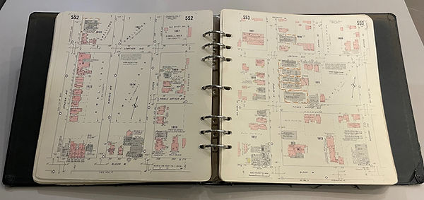
The practice of revising old Goad’s plans came to an end in 1952 when the USB introduced a new format. Plans were now printed on 30cm by 33cm (11.8" x 13") pages at a scale of 100 feet to 1 inch that were hole punched and assembled in ring binders. The new binding system made updates much more economical as individual outdated pages could easily be replaced as required, largely eliminating the need for labour-intensive revision slips. Fire insurance plans had at last entered the modern age, the same age that would soon render them redundant.
Canadian Underwriters’ Association (1965-1973)

CUA motif circa 1945 - 1965
During the decades that the plans were being produced by the Underwriters’ Survey Bureau, its parent organization underwent some significant restructuring. In 1936 the CFUA merged with automobile and casualty insurance organizations in its Ontario and Quebec jurisdiction to become the Canadian Underwriters’ Association. Then, around 1960, the country’s other regional associations gradually amalgamated under the CUA banner, giving the association a national scope that finally lived up to its name.
As part of this expansion, the USB was folded into the Association as its plan division which also took over plans produced by Western Canada Fire Underwriters' Association and British Columbia Underwriters' Association. Accordingly, all of the new division's plans began using the CUA imprint in 1965[15]. As before, the plans were for the exclusive use of Association members who were required to return them upon the publication of a new edition or upon leaving the organization.

Genealogy of CUA predecessors that published their own plans.
Insurers' Advisory Organization (1974-1975)
The new version of the CFUA lasted only until June 1974 when it was dissolved and replaced by the Insurers' Advisory Organization of Canada. Instead of regulation, the IAO’s mandate was to provide its members with advice and information. At the same time, the need for expensive fire insurance plans came to an end. “The existence of mandatory building codes and standards for fire services,” explains Jean Dryden, “meant that data about firefighting, fire prevention services, and building construction could be acquired from municipalities. The insurance business had developed cheaper, less cumbersome ways of recording and analyzing liability data, and plans were no longer needed.”
A delayed 1973 revision to the Winnipeg plan was issued in 1975 under the CUA imprint and became the last official publication.
Although the IAO did not produce any new maps, a delayed 1973 revision to the Winnipeg plan was issued in 1975 under the CUA imprint and became the last official publication. It was a fitting milestone, falling exactly one hundred years after Charles Goad's first circular. This could have well been the end of the story for Canada’s fire insurance plans but instead it marked the beginning of a new and very different chapter.
Other Fire Insurance Plan Publishers


Goad and his successors, the Underwriters Survey Bureau and Canadian Underwriters Association, dominated the market east of Manitoba. Only a few plans were published by competitors Mount Royal Assurance Company (1910s) in Quebec and Provincial Insurance Surveys Limited (1936-1945) and C. N. Lloyd (1946-1955) in Ontario. The Canadian Fire Underwriters' Association also competed briefly with the Chas E. Goad Company during during the firm's first and final years.
In Manitoba, Saskatchewan and Alberta, Goad was the primary publisher with minimal competition from the Western Atlas Company (1910-1912) and the Western Canada Fire Underwriters Association. Similarly, the Mainland Fire Underwriters' Association and Vancouver Island Fire Underwriters' Association published a few British Columbia plans at the same time that the Goad Company was active. These regional Associations would take over Goad's plans for their jurisdictions when the company closed in 1917 and their successors would eventually amalgamate with the CUA.
All publishers used the same standard scale and the same size sheets as the Goad plans and most even used the same symbols and colour coding.
Legacy
Seminal Public Collections
Just as underwriters’ need for fire insurance plans was coming to an end, urban historians’ interest in the maps began to emerge.
In 1973, Robert Hayward of the National Map Library (now Library and Archives Canada) wrote that “until recently, few realized that there existed plans and atlases that were exclusively Canadian in nature. With thanks to certain individuals with keen archival senses, some have survived.” Those researchers who were aware of them faced the dual problems of availability and accessibility which Hayward was hoping to resolve. “In an effort to build upon these fine, yet limited, resources, the National Map Collection is conducting an inventory of these historic documents. Urban historians and others may be aware of the location of copies of these plans and atlases. I would appreciate being informed of such collections.”[16]
The greatest collection of all became available when the IAO, seeing little value in the outdated maps they had inherited, fortuitously decided to sell off their holdings.
Only one year later, the greatest collection of all became available when the IAO, seeing little value in the unused stock of plans they had inherited, fortuitously decided to sell off their holdings. Their Pacific Region records were deposited with the University of British Columbia Library while Ed Phelps, an independent publisher and Western University librarian, purchased most of the inventory at their Toronto head office. In the fall of 1976, Phelps issued a typewritten catalogue of his mint condition plans he was now offering for re-sale.


The National Map Library may have been one of Phelps’ biggest customers as the 1977 publication Fire Insurance Plans in the National Map Collection was prefaced with an acknowledgement of his cooperation. Robert Hayward’s introduction explained that “large-scale urban maps are now the most sought-after documents in the National Map Collection, a phenomenon attributable to the growing interest in Canada’s urban past” and went on to describe the origins of the institution’s collection:
Beginning from a small nucleus acquired in the 1920s, the holdings of the National Map Collection were enriched in 1973 with the acquisition of the Canadian plans and business records from the English map publishers, Chas. E. Goad, Ltd.[17] Two years later, as a result of the decision taken by the Insurers’ Advisory Organization to sell its stock of plans, a further, and by far the largest, addition was made. The number of plans in the National Map Collection now totals two thousand, consisting of twenty-nine thousand sheets documenting more than fourteen hundred places.
Hayward conceded that this inventory was by no means the definitive listing of Canadian fire insurance plans, estimating that the catalogue included only about one third of all surviving plans and noting that there were significant gaps in the holdings. However, he hoped that the publication of this booklet would encourage the search for additional plans both in public institutions and in private collections and lead to “a greater appreciation and the further collecting, cataloguing and use of these valuable cartographic documents”.
Phelps noted in his own catalogue that many obsolete plans were known to exist “in the hands of insurance companies and their agents” and that he was willing to purchase them in light of their considerable research value.
Seeking out a complete collection of plans was ambitious aspiration considering the minimal quantity originally printed — only 50 to 100 copies of each — and their various publishers’ policy of “systematic destruction,” as Hayward aptly phrased it. Yet, over the years, more and more privately held editions found their way into public collections. Some were provided by their original owners, such as the volumes of Toronto plans from the 1910s now held at the York University Archives that were once the property of the Toronto Harbour Commissioners. Some were donated by the IAO itself[18]. Many other volumes, according to the Archives of Ontario’s collection overview, were plucked from dumpsters.
Edward Phelps

At the time that the IAO offered their plan inventory for sale, Ed Phelps was an active historian and archivist, head of the Regional Collection at Western University's D. B. Weldon Library, and independent publisher of mostly "rhetorically arid chronicles of unenticing arcana” in the words of one colleague. His collective interests made him a natural fit to acquire the historical fire insurance plans and it appears that, despite issuing his 1976 catalogue and a 1983 follow up and selling plans to institutions such as Trent University, his motives were not entirely financial. His re-sale prices ranged averaged $12.30 per sheet adjusted for inflation, a bargain considering that a single page can retail for over $1,000 today. Furthermore, he seems to have been generous in giving away copies to various academic institutions. Some editions held in Western's substantial repository bear a sticker identifying Phelps as the donor, and the University of British Columbia’s Edward Phelps Collection of Fire Insurance Plans contains maps of 600 cities and towns that Phelps provided in 1982.
Phelps also played a significant role in the creation of microfiche copies of plans held by himself and Western University in the 1970s and ‘80s which allowed the maps to be more accessible to the public in the days prior to the internet.
Phelps’ extensive expertise regarding Goad’s maps is acknowledged by the authors of the National Map Collection’s Fire Insurance Plans catalogue and the Catalogue of Canadian Fire Insurance Plans, and his close working relationship with the IAO is evidenced by his publishing of the organization’s 1985 centennial history and his assembly of that book’s graphic materials.

Donated plan held in Western University's collection.
Copyright Conflict
As the diaspora of retired plans was consolidating itself in public collections, the IAO found itself regretting their decision to let the maps out of their hands. In the late 1980s, new environmental regulations required developers to clean up lands formerly utilized for industrial purposes which made the historical land use information in the old plans commercially valuable once again.
The IAO demurely asked various libraries and archives to lend them their plans so they could be copied for use as a new revenue stream which they christened Historical Environmental Information Reporting System or “HEIRS”. Parallel to this initiative, their legal department threatened the same institutions with litigation if they allowed anyone else to reproduce editions less than 90 years old, which they considered to be still within copyright[19].

HEIRS was inherited by the Underwriters’ Adjustment Bureau in 1992 when they purchased IAO, then by business and IT consulting firm CGI which acquired UAB in 2002, followed by SCM Insurance Services which bought CGI’s claim and risk management operations in 2008. In 2012 SCM formed Opta Information Intelligence which became responsible for the historical insurance plans through its Enviroscan service. Opta was subsequently acquired by Verisk in 2022 which retired the HEIRS trademark but continues to offer the plans under the Enviroscan banner.
Meanwhile, the continued growth of public collections in the late twentieth century was made evident in 1995's Canadian Fire Insurance Plans in Ontario Collections. The tome listed almost 500 editions held by various libraries and archives in that province alone, many of which consisted of multiple copies. Response to the book was so favourable that the authors expanded it into Catalogue of Canadian Fire Insurance Plans in 2002.
Access to these growing collections took a major leap forward with the advent of the internet as many institutions posted digitized copies of their atlases and plans online during the early years of the new millennium. However, these initiatives were largely limited to Goad-era plans based based on repeated reminders from IAO successors of their copyright claim.

Library and Archives Canada digitized their early plans and locked away their newer ones.
The battle over public access continued into the new millennium. In 2018, Library and Archives Canada, the largest repository of plans in the country, acquiesced to the current claimant's demand for more restrictive conditions than imposed by its predecessor. Conversely, much smaller institutions have digitized plans that fall well within the claim period, regardless of the threats of legal action.
Epilogue
While it can't be known exactly when all plans will be freely accessible, the inevitably of this day is a given: Canadian law limits copyright protection of a work to 70 years after the death of the author(s), no matter what claims have been made by the IAO or its successors.
The idea of these plans one day being available to everyone, everywhere, at the touch of a finger would have no doubt been unfathomable to Charles Goad as he sketched his first surveys in a cold Quebec winter back in 1875. But it's likely he would have taken pride in the fact that many people today still refer to the collective body of work produced long after his death simply as "Goad's Plans".
Notes
PRELUDE TO GOAD
[1] Sanborn surveyed Toronto, London, Guelph, Hamilton, St. Catharines, Brantford, Kingston, Belleville, Cobourg, Port Hope, Lindsay, Peterborough, Ottawa and Brockville. Only the Guelph plan has survived.
CHARLES E. GOAD
[2] There were later claims that Goad was educated at Oxford University but Dictionary of Canadian Biography indicates that there is no verifiable evidence of this.
[3] “Circular” was the term used by Goad for his official correspondence, typically delivered as a mass mailing to existing and potential customers. They varied in physical size, but most were 8" x 5" flyer size (like most of the ones depicted on this page) or 10" x 8" (like Goad's first letter).
[4] Goad historians appear to consider this announcement as the launch of his fire insurance plan venture and Goad himself states in the January 1881 issue of Insurance Society that he first proposed his system of Block Plans "five years ago" i.e. 1875. (This is the same issue where he admits most other people didn't think the venture to be a wise one.) However, in a circular from July 1888, Goad cites that year as his "fifteenth year of continuous work" which would suggest an 1873 origin and in 1889 Goad references his “first series of Block Plans (1874)”. There is no indication of what places were surveyed prior to Lévis nor for whom they were produced. As for Lévis being the largest Canadian place not surveyed by Sanborn, the American surveyor’s original maps did not include Montreal, the most populous city in the country by far.
[5] This is Goad’s first reference to what he would later label “a system of Block Plans of Cities and Towns for the use of Insurance Companies”. Goad never defined what qualified it as a formal “system” and only announced its official completion in 1880 by which point he had already published more than 135 plans.
[6] In an issue of Insurance Society, Goad states that some insurers "were induced to subscribe a portion of the cost of the first survey" which suggest his use of "subscribe" aligns more with a period definition found in the 1828 Webster's Dictionary: "to promise to give by writing one's name; as, each man subscribed ten dollars or ten shillings." Goad did provide some copies on long term loan but only to local agents who would receive a copy at no charge for each insurer they represented which had purchased their own copy, as outlined in the sample loan condition notice.
[7] A March 1883 circular included a breakdown of the nationality of insurance companies doing business in Canada: 17 were British agencies, 4 were American and only 7 were Canadian.
[8] The publication is referenced in a promotional handout that Goad company records date to January 1879 which means it is either misdated or Charles was premature in advertising its availability.
[9] Sanborn had created plans for Granville, Victoria and Yale in 1885.
[10] Specifically Cuba, Jamaica, Barbados, Trinidad, Antiqua, St. Thomas, and St. Kitts.
CHAS. E GOAD COMPANY
[11] “Copyright in Fire Insurance Plans” article in Archivaria, The Journal of the Association of Canadian Archivists Number 91, Spring-Summer 2021. The Supreme Court reference pertains to a 1930s Canadian Fire Underwriters’ Association lawsuit against non-members that were copying their plans.
[12] The Underwriters, the History of the Insurers’ Advisory Organization and its Predecessors, the Canadian Fire Underwriters' Association and the Canadian Underwriters' Association (1883-1983). Christopher L. Hives. London, Phelps Publishing Company, 1985.
[13] Although the Chas. E. Goad Company was succeeded by Goad’s Atlas and Plans Company, it lasted only long enough to publish a 1923 revision of the Toronto atlas.
UNDERWRITERS’ SURVEY BUREAU
[14] Because the USB wasn’t incorporated until October 1917, there were three imprints in use that year: the CFUA prior to October, the USB after October and the Chas. E. Goad Company throughout the year.
CANADIAN UNDERWRITERS’ ASSOCIATION
[15] Numerous historical sources conflate the amalgamation of the CUA with the appearance of the CUA imprint on insurance plans in 1965. However, Underwriters, the History of the Insurers’ Advisory Organization and its Predecessors specifies that the former took place prior to the latter: WCUA and BCUA were amalgamated with the CUA on January 1, 1959 and the remaining associations amalgamated on January 1, 1962, three years prior to the appearance of the imprint.
LEGACY
[16] May 1973 issue of Urban History Review.
[17] Unlike the Canadian division of Goad’s, the UK bureau had continued to operate until the early 1970s.
[18] At least one plan in the Western University's collection has a label indicating it was a "Gift To UWO Library From Insurers Advisory Organization Toronto 1980".
[19] The claim was established in a benchmark agreement with the Archives of Ontario in 1995. Its impact is explored in detail in the COLLECTIONS & COPYRIGHT section.
Illustration Credits
PRELUDE TO GOAD
-
W. S. Boulton's Atlas of the City of Toronto and Vicinity plate XXVII: Toronto Public Library
-
1875 D. A. Sanborn fire insurance plan of Guelph revised 1881 by Chas. E. Goad: University of Guelph McLaughlin Library Map Collection G3401.G475 1875-05G84
CHARLES E. GOAD
-
1875 circular: Peter Marshall. (Archives of Ontario, "Fire Insurance Plan circular letters", series C 234-2-0-2, circular 1
-
undated Charles Goad portrait: Library and Archives Canada, reference C-76036
-
fire insurance plan of Napanee: Museum of Lennox and Addington
-
April 1877 surveys circular: Peter Marshall (Archives of Ontario, "Fire Insurance Plan circular letters", series C 234-2-0-2, circular 15)
-
1879 promotional card: Peter Marshall (Archives of Ontario, "Fire Insurance Plan circular letters", series C 234-2-0-2, circular 41)
-
portraits of Charles and Margaret Goad, 1879. City of Vancouver Archives (Charles, Margaret)
-
London plan circular: Peter Marshall (Archives of Ontario, "Fire Insurance Plan circular letters", series C 234-2-0-1.4, circular 209)
-
London plan: Insurance Plan of City of London Vol. I 1886 key plan, Wikimedia Commons
-
Manitoba & Northwest Territories circular: Peter Marshall (Archives of Ontario, "Fire Insurance Plan circular letters", series C 234-2-0-1.5, circular 256)
-
Loan notice: from Insurance plan of Almonte, 1879 revised to 1884, Library and Archives Canada
-
Commercial Bank Building, 1955: Toronto Public Library Digital Archive Ontario
-
Goad family monument at Mount Pleasant Cemetery: Find a Grave
OTHER GOAD PUBLICATIONS SIDEBAR
-
Insurance Society, volume 1, number 1, January 1881: Peter Marshall (Library and Archives Canada, OCLC number 668081628, call number H-773-1)
-
Reference Book to Accompany Fire Insurance Plan of Windsor: Peter Marshall. (Archives of Ontario, "Fire Insurance Plan reference books, series C 234-3)
INDUSTRIAL PLANS SIDEBAR
-
manufacturing complex in Montreal: Library and Archives Canada
-
New Brunswick Cotton Mills: Library and Archives Canada
-
E. B. Eddy plant: Library and Archives Canada
-
St. John's Stone Chinaware Company factory: Library and Archives Canada
-
grain elevators in Winnipeg and Oshawa: Library and Archives Canada
-
Ogilvie Flour Mills in Winnipeg: Library and Archives Canada
-
Ogilvie Flour Mills in Fort William, Ontario: Library and Archives Canada
CHAS. E GOAD COMPANY
-
CUA imprint from plan of Clinton, Ontario: Peter Marshall
-
Chas. E. Goad Co. logo with Vancouver and Winnipeg offices: Goad's Atlas of Vancouver Volume 2, 1912, index to streets. Vancouver Archives
UNDERWRITERS’ SURVEY BUREAU
-
USB employees working on insurance plans: The Underwriters: The History of the Insurers' Advisory Organization and its Predecessors, p133
-
Norwich Union Record of Risks: Peter Marshall
CANADIAN UNDERWRITERS’ ASSOCIATION
-
"Board Insurance" logo: The Underwriters: The History of the Insurers' Advisory Organization and its Predecessors, p134
OTHER FIRE INSURANCE PLAN PUBLISHERS SIDEBAR
-
C. N. Lloyd plan of Toronto: Peter Marshall
-
Western Canada Fire Underwriters' Association plan of Saskatoon: Library and Archives Canada
-
Provincial Insurance Surveys plan of North Bay: Peter Marshall
-
Mount Royal Assurance Co. plan of Beebe Plain, Quebec: Library and Archives Canada
-
British Columbia plans: Peter Marshall
LEGACY
-
fire insurance plan catalogues:
-
Fire Insurance Plans of the Dominion of Canada cover: Peter Marshall
-
Fire Insurance Plans in the National Map Library cover: Internet Archive
-
-
HEIRS report cover: City of Orillia
ED PHELPS SIDEBAR
-
Ed Phelps photo: courtesy of Herman Goodman
-
Port Credit, Ontario plan, 1928: Peter Marshall